
Background
Columbus County is the third-largest county in North Carolina, home to nearly 60,000 residents and served by departments spanning everything from Emergency Services to Animal Control. Like many counties, it had used GIS for years — desktop software and databases producing maps and reports on request. But that information changes daily, from a deed transfer on a property to the re-surfacing of a county road, and keeping everyone on the latest version is critical for asset management, tax assessment, and planning.
The question was how to deliver all of that to end users over the internet — tapping into existing systems and databases, securely and with minimal upkeep.
The problem Mango solved
Alan James, from the county's Information Systems department, led the search for a web GIS. The county wanted to replace an older server-based system that was, in his words, antiquated, expensive to maintain, and missing the essentials of a modern platform: current-browser and mobile support, and cloud availability.
An experienced desktop-GIS user, Alan was drawn to Mango for a specific reason:
What immediately impressed me was how quickly I was able to upload data and get a useful map published. Other products I tried required more time in the learning curve than I could afford.
Working with different departments, he built around a dozen thematic maps — Land Records, Flood Mapping, School Districts, and more — then deployed the portal to the county website. Because the pricing was attractive, he could fund it from existing budget and launch without waiting for high-level approval or the next budget cycle.
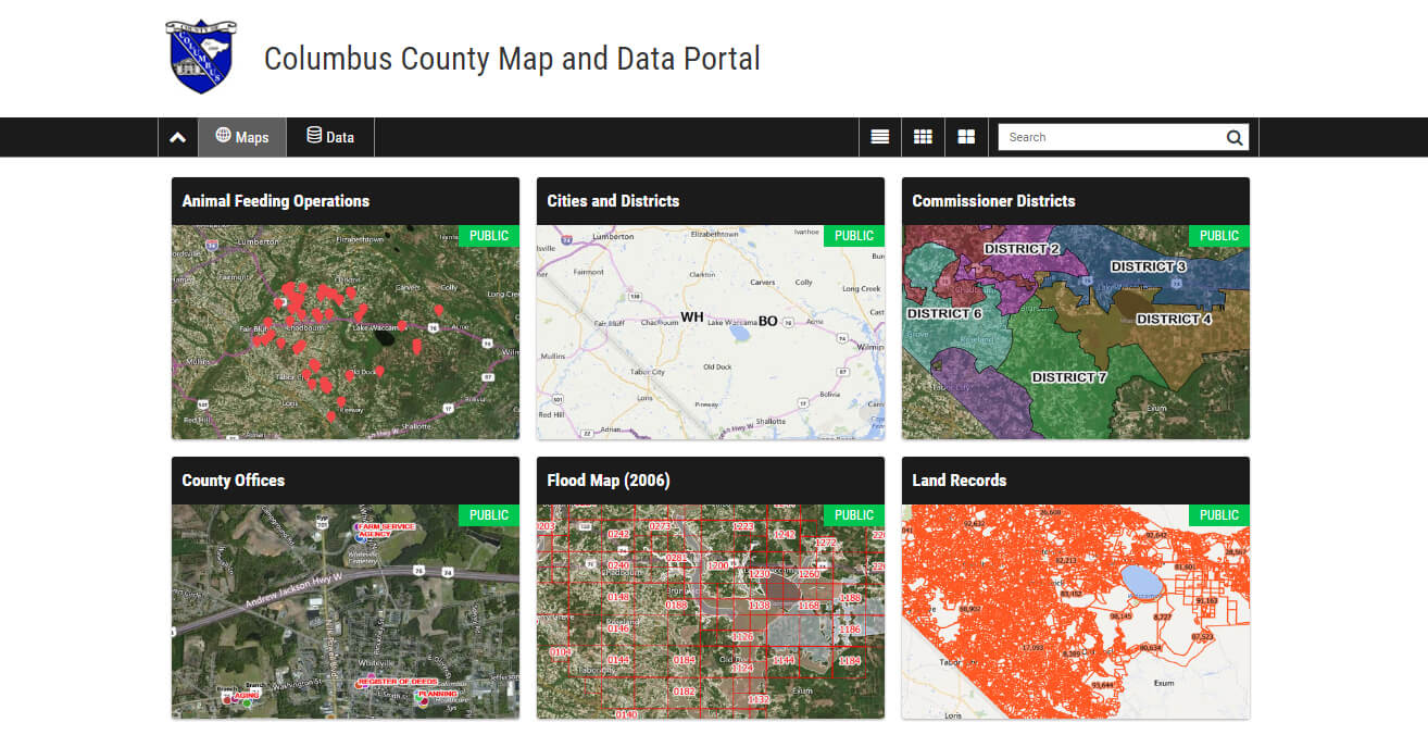
The county didn't stop at publishing its own data. It pulled in high-resolution aerial photography from the state's "NC OneMap" initiative as a WMS layer, giving users a bird's-eye view across public and private land, and linked out to documents held in other county databases — tax statements, deeds, and property cards — all reachable from one map.
Results
Three years in, the proof was in the numbers.

The portal draws more than 17,000 views a month, from citizens, county staff, and appraisers alike. And Columbus isn't stopping there: the county is working toward deeper integration between Mango and its property-parcel database, so anyone browsing a conventional record can jump straight to it on the map.